Rithickkannan S

Rithickkannan S

@MISSIONSOCIETY

Student

Annamalai University
India
Joined Early Thinker
··
840 coins

About

<<<AGRICULTURIST💚 >>THE KEY TO SUCCESS IS ACTION✨ >>> COSMOPOLITAN 💪>>> >>> NATION FIRST🇮🇳 >>>

Activity & Published Literature

14 works inscribed by Rithickkannan S

Rithickkannan S
Rithickkannan S
@MISSIONSOCIETY•Nov 2•
Article

REMOTE SENSING

Remote Sensing: Uses its own energy source and records the reflected signal. Example: RADAR and LiDAR. COMPONENTS Energy source: Sun or artificial energy. Atmosphere: Medium through which energy travels. Target: Object or area being studied. Sensor: Detects reflected or emitted energy. Data processing: Converts collected data into useful information. Interpretation: Analyses the information for decision-making. APPLICATION IN AGRICULTURE *Crop health monitoring. Identification of crop diseases and nutrient deficiencies. Soil moisture assessment. Drought monitoring. Crop acreage estimation. Yield prediction. Irrigation management. Flood and disaster assessment. ADVANTAGES: Covers large geographical areas. Saves time and labour. Provides repeated observations. Helps in precision agriculture. Supports better farm management.
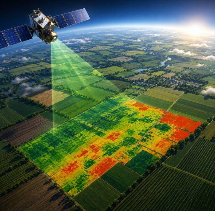
REMOTE SENSING
•Open
Rithickkannan S
Rithickkannan S
@MISSIONSOCIETY•Oct 24•
Poll

Which is the main function of GIS in precision farming?

Select an option to cast your vote • 4 total votes

•Open
Rithickkannan S
Rithickkannan S
@MISSIONSOCIETY•Oct 23•
Article

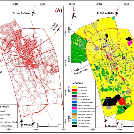
GIS

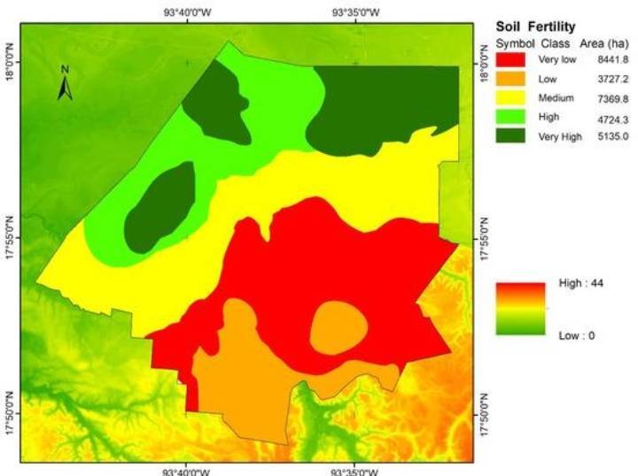
GIS GIS stands for Geographic Information System. It is a computer-based system used to collect, store, manage, analyse and display geographical data. Soil Fertility Mapping: Identifies soil types, pH and nutrient distribution.Crop Monitoring: Helps monitor crop growth and identify unhealthy areas. Fertilizer Management: Supports site-specific fertilizer application based on soil and crop requirements. Irrigation Management: Helps plan irrigation according to soil properties and field conditions. Yield Mapping: Identifies variations in crop yield across a field. Pest and Disease Management: Maps affected areas to support targeted management. Land Use Mapping: Helps identify agricultural land boundaries and land-use patterns. Watershed Management: Supports water conservation and soil erosion control. Components of GIS: Hardware Software Data People Methods This is the basic info about GIS

GIS
•Open
Rithickkannan S
Rithickkannan S
@MISSIONSOCIETY•Oct 22•
Poll

Which statement correctly describes the relationship between GPS and GNSS in precision farming?

Select an option to cast your vote • 2 total votes

•Open
Rithickkannan S
Rithickkannan S
@MISSIONSOCIETY•Oct 22•
Article

GPS AND GNSS

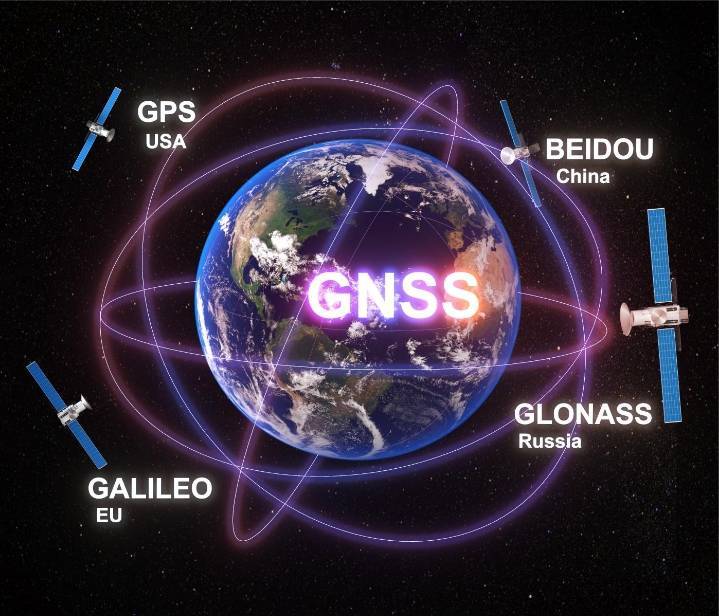
GPS (Global Positioning System) and GNSS (Global Navigation Satellite System) are satellite-based positioning technologies used to determine the geographical location of objects on or near Earth.In precision farming, they help farmers identify exact field locations, guide agricultural machinery, map soil variability and manage farm inputs accurately. Components OF GPS/GNSS 1. Space segment Satellites orbiting Earth transmit positioning and timing signals. 2. Control segment Ground stations monitor satellite performance and maintain orbit and clock information. 3. User segment Receivers in tractors, drones and surveying equipment calculate their position using satellite signals. GPS = one satellite navigation system; GNSS = the broader group of satellite navigation systems; RTK = a high-precision positioning technique.

GPS AND GNSS
•Open
Rithickkannan S
Rithickkannan S
@MISSIONSOCIETY•Oct 11•
Article

PRECISION FARMING

Precision farming is an agricultural approach that manages variations within a field to improve productivity and resource-use efficiency. • 1.GPS/GNSS. Determines the precise geographical location of farm equipment and field areas. Used for tractor guidance and field mapping. 2. GIS (Geographic Information System) Stores, analyses and displays spatial data such as soil fertility, crop distribution and field variability. 3. Remote Sensing Uses satellite or airborne sensors to monitor crop health, vegetation, drought and crop growth. 4. Agricultural drones (UAVs) Capture aerial images for crop monitoring, field surveying and targeted spraying where appropriate. 5. Soil and crop sensors Measure soil moisture, temperature, electrical conductivity and other crop or soil conditions. 6. Variable Rate Technology (VRT) Adjusts the rate of fertilizer, seed or other inputs according to field requirements. 7. Auto-guidance and steering systems Guide tractors along accurate paths, reducing overlap and missed areas during field operations. 8. IoT (Internet of Things) Connects field sensors and devices to monitor conditions and support automated irrigation and other farm operations.

PRECISION FARMING
•Open
Rithickkannan S
Rithickkannan S
@MISSIONSOCIETY•Oct 7•
Poll

World longest river?

Select an option to cast your vote • 7 total votes

•Open
Rithickkannan S
Rithickkannan S
@MISSIONSOCIETY•Oct 7•
Article

SPIRAL DATA IN GIS

Geospatial data has significantly different structure and function. It includes structured data about objects in the spatial universe – their identity, location, shape and orientation.In geographical data all the objects are described in terms of points, lines, tables and polygons constituting the tabular portion of geospatial data. GIS technology accommodates some kinds of unstructured data (raster imagery) that can be tagged and geocoded and integrated by GIS software with the other kinds of map data. Raw GIS data is generally meaningless for human eye until converted into a map. THIS IS THE BASIC INFORMATION ABOUT SPIRAL DATA IN GIS

SPIRAL DATA IN GIS
•Open
Rithickkannan S
Rithickkannan S
@MISSIONSOCIETY•Oct 5•
Poll

GSLV FULL FORM?

Select an option to cast your vote • 6 total votes

•Open
Rithickkannan S
Rithickkannan S
@MISSIONSOCIETY•Sep 28•
Poll

Highest rice production State?

Select an option to cast your vote • 8 total votes

•Open
Rithickkannan S
Rithickkannan S
@MISSIONSOCIETY•Sep 24•
Story

ARTICLE 370

ARTICLE 370: HISTORICAL CONTEXT, ABROGATION, AND CONSTITUTIONAL IMPACT Comprehensive Legal and Historical Analysis of Jammu & Kashmir's Accession and Integration This article offers an in-depth analysis of Article 370 of the Indian Constitution, detailing its journey from its origins in the 19th-century Treaty of Amritsar to its abrogation on August 5, 2019. It reviews key milestones, including Gulab Singh’s appointment as Raja of Jammu by Maharaja Ranjit Singh in 1822, the 1846 Treaty of Amritsar with the British, and Maharaja Hari Singh’s accession of Jammu and Kashmir in 1947. The study also explores the development of special privileges through the 1952 Delhi Agreement and Article 35A, the legal changes following the 2019 reorganization, and the Supreme Court’s unanimous verdict upholding the abrogation to reinforce national integration Prior to independence, India was a complex mix of British-governed provinces and over 550 autonomous princely states. After British rule ended in 1947, the new nation began integrating these territories into a single Union. While most states joined smoothly, three—Hyderabad, Junagadh, and Jammu & Kashmir—held back initially. Hyderabad was later integrated through a military operation (Operation Polo), and Junagadh joined after a public referendum. Jammu & Kashmir took a different path, leading to a unique and temporary status within India's federal structure. . https://substack.com/@missionsociety

•Open
Rithickkannan S
Rithickkannan S
@MISSIONSOCIETY•Sep 20•
Article

AI IN AGRICULTURE

Carbon Robotics is a leading agriculture technology company that provides cost-effective, efficient and sustainable solutions for farmers. We pioneered our laser-weeding technology as an alternative weed control method that enables growers to save time and money on one of their most expensive and time-HortiBotis sprays exactly above the weeds. It is also cheaper than the tools currently used for weed-elimination as it can work extended periods of time.consuming tasks: weed control.Artificial Intelligence (AI) and robotics are transforming weed management by enabling precise identification and removal of weeds while reducing dependence on conventional herbicide and manual lab AI IN AGRICULTURE IS IMPORTANT

AI IN AGRICULTURE
•Open